
The year 2023 was the warmest on record and the warmest by far according to scientists from the National Oceanic and Atmospheric Administration’s National Centers for Environmental Information (NCEI). South Africa’s temperature records bear this out and show an upward trend – ‘overall, we see the persistent rise of temperatures, with the period of 2013-2018 period unprecedentedly warm’. A Greenpeace report from August 2023 notes that mean annual temperatures in South Africa have increased by twice the global average (0.7°C). Climate projections for the country point to an increase in mean, maximum and minimum temperatures; and increases in very hot days – above 35 °C and in the frequency of heat wave events.
Warming in cities has severe impacts on human health and well-being, affecting the natural and physical environment compounding water and food shortages with significant economic implications.
As climate change intensifies, cities across the world are seeking to deepen their understanding of the effects of this change and how best to plan for a future characterised by heightened risks and vulnerabilities. The IPCC Third Assessment Report (TAR) describes vulnerability as a system’s susceptibility to or ability to cope with the adverse effects of climate change, including its variability and extremes and its ability to respond and adapt.
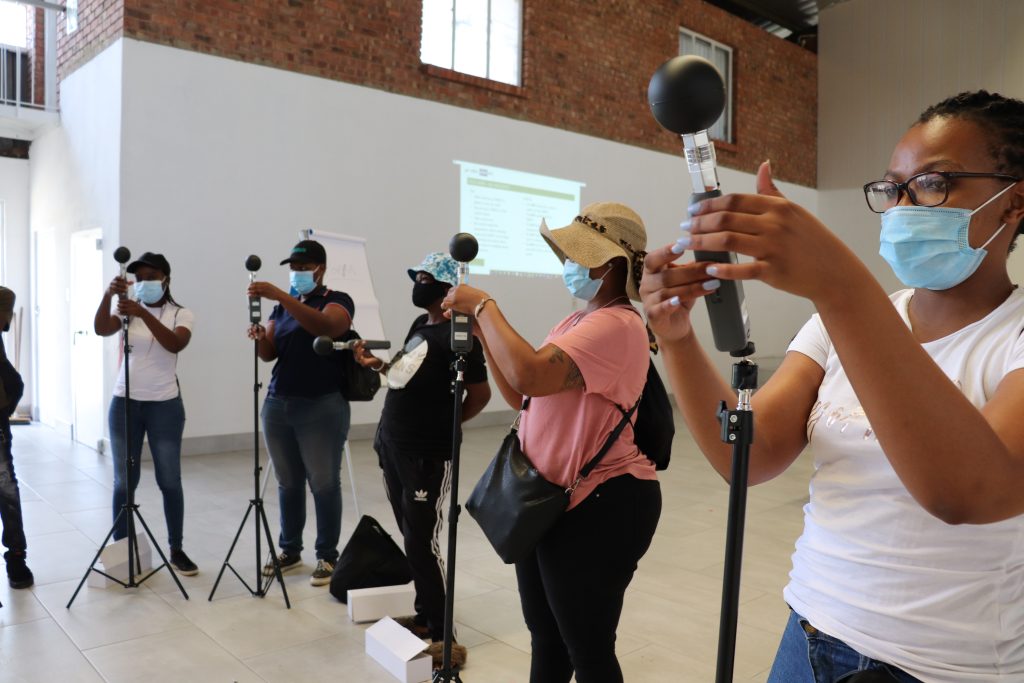
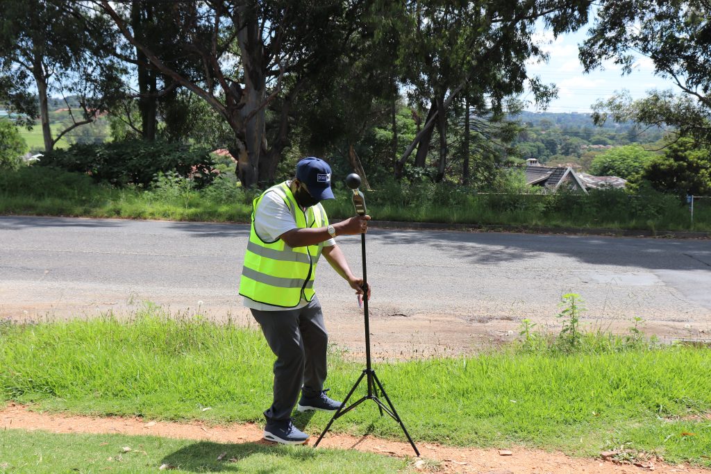
It is in this context that Planact in consultation with partners, including communities, the municipality, the National Treasury, donors, the World Bank and CAPA Strategies are in the final stages of planning a heat monitoring exercise to take place on 8 March 2024 in the City of Tshwane in Gauteng province. The goal of the exercise is to develop a city adaptation and resilience plan to mitigate the effects of heat.
In this Citizens Science initiative, a temperature monitoring sensor will be employed and attached to a vehicle to collect geospatially referenced heat data for a day at three different times – morning, early afternoon, and evening across an area of just over 200 kilometres. This distance will take in the north, central, eastern, and western parts of the city. It will provide an opportunity to identify contrasts in the temperature, levels of humidity and other data across this polygon area. From the data gathered on the day, it is possible to create high-resolution descriptions of ambient heat at the human level.
The mapping exercise will seek to expose the extent to which certain areas of the city are more susceptible to temperature to develop plans and appropriate responses demonstrating that local action will be key to addressing climate change. The area that has been identified incorporates a cross-section of income levels across neighbourhoods and equipped with the data, it will be possible to identify marginalised communities that lack green spaces and other infrastructure who bear a disproportionate burden from the health and economic costs associated with urban heat. This is exacerbated by living conditions and homes constructed with materials that offer no insulation and in conditions that make it harder to address the impacts of heat.
It may also reveal issues associated with Urban Heat Islands with far-reaching health implications, and declining productivity. Citizens, businesses, and organisations grappling with the effects of heat resort to air conditioning systems that drive up carbon emissions.
What might responses look like?
The programme is designed to create awareness directly with community members who will be integral to the rollout of the heat mapping exercise. Incorporating climate change into school educational programmes, community dialogues, workshops and increased campaigns and advocacy responses must also be developed and implemented.